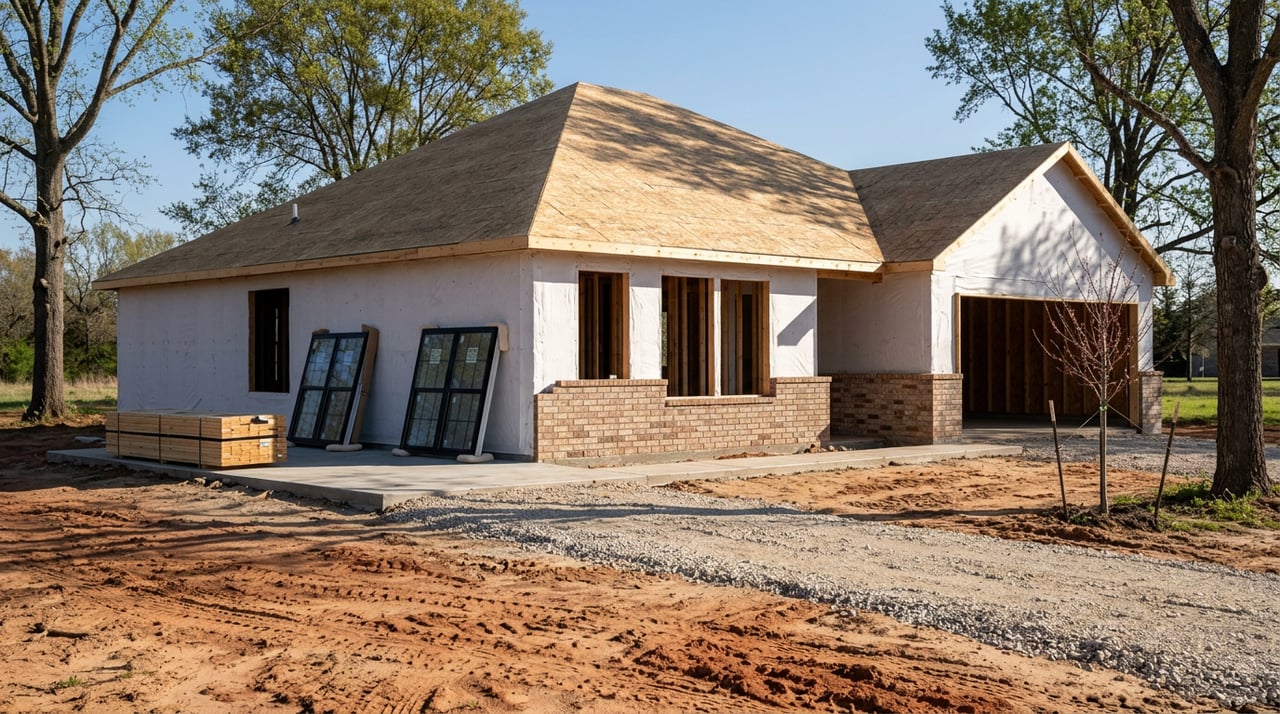
Buying acreage near Washington can feel exciting and a bit overwhelming. You want room for livestock or a future homesite, but every rural tract is different. The smartest move is to ask the right questions and verify key details up front so you avoid surprises later. In this guide, you’ll learn how to confirm water and wastewater options, legal access, minerals, soils, flood risk, and typical improvement costs for McClain County parcels. Let’s dive in.
Water and wastewater basics
Reliable water and a permitted wastewater solution are nonnegotiable. Without both, a parcel may be hard to build on or support livestock long term. Start here before you get attached to a tract.
Wells: what to verify
If a property has an existing well, ask for the well completion report (well log), pump age, pump test results in gallons per minute, static water level, total depth, any lab water test results, and maintenance records. The Oklahoma Water Resources Board (OWRB) oversees well-driller licensing and completion reporting. You can review well rules and request records through the OWRB’s resources on water permitting and well-driller licensing. See the OWRB guidance on domestic vs permitted use in the water-permit overview and use the OWRB well-driller licensing page to confirm driller information.
- Review OWRB’s domestic use rules and permit guidance in the OWRB’s Apply for a Water Permit page: groundwater permitting basics.
- Confirm the driller and completion report details using the OWRB’s licensing information: well driller licensing and reporting.
If there is no well, confirm whether your intended use qualifies as domestic. In Oklahoma, a single-household domestic well and small-scale livestock irrigation on up to roughly 3 acres often do not require a groundwater use permit. Non-domestic or higher capacity uses do. Domestic wells still must be drilled by a licensed driller and reported to the OWRB. Ask local drillers for nearby well logs, expected depth and yield, and a written estimate before you write an offer.
Red flags to watch for:
- No OWRB completion report, only a seller note about a well.
- Very low or inconsistent yield without a recent pump test.
- No recent lab potability test on a household well.
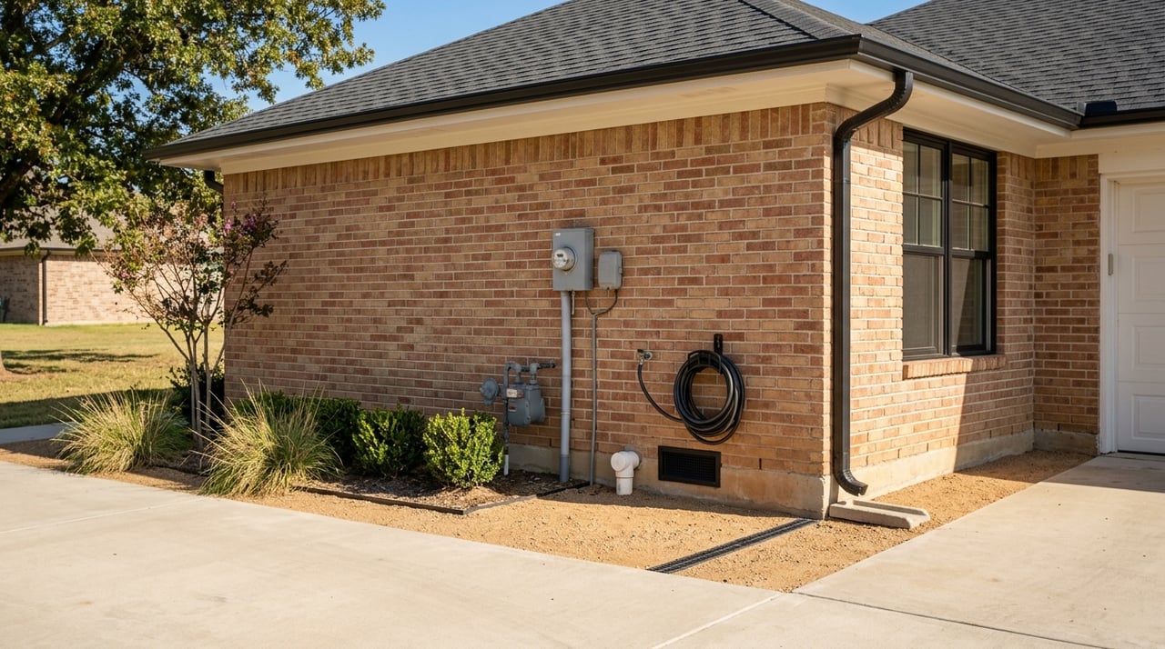
Septic systems: permits and capacity
On-site sewage systems in Oklahoma are regulated. Ask the seller or listing agent for the septic permit or Authorization to Construct, the final inspection or contractor affidavit, and the installer’s name. You can review permit and installer requirements through the Oklahoma Department of Environmental Quality (DEQ) and confirm installer credentials using the DEQ’s certified installers list: DEQ on-site sewage and certified installers.
If you plan multiple bedrooms or a higher wastewater load, talk with DEQ and the McClain County Health Department early about system type and capacity. The local health department can help you locate any records and explain county-level steps: McClain County Health Department.
Red flags to watch for:
- No permit record for a claimed septic system.
- Evidence of an unpermitted or “informal” system.
- Soils that point to aerobic or alternative systems without confirmed design.
Access, title, and minerals
How you legally reach the property and what rights come with it can change your plan. Do not skip this step.
Prove legal access
Confirm whether access is by a county-maintained road or by a recorded private easement. Ask for the current deed and use the McClain County Clerk’s office to pull any recorded easements, rights-of-way, or plats that impact access: McClain County Clerk. If access relies on a private easement, confirm who maintains it and whether there are width or use limits. A current survey will help you see the access location, easements, and any encroachments.
Why a survey matters
A boundary survey verifies acreage, pins corners, and maps easements and improvements relative to the lines. In rural areas, a survey can take time, so order it early. Costs vary with acreage, terrain, tree cover, and research time. If you are financing, your lender may require a specific survey type. Ask your surveyor for a written scope and deliverables.
Minerals and oil/gas activity
In Oklahoma, the mineral estate is often separate from the surface estate. A mineral owner or operator may have rights to access the surface, subject to state rules. Ask the seller about mineral reservations or leases and review your title commitment for exceptions. Use the Oklahoma Corporation Commission Oil & Gas Division to search for nearby wells, permits, pooling orders, and imaged records that may affect your plans: OCC Oil & Gas well data and orders.
Red flags to watch for:
- Unrecorded or implied access. Require a recorded easement.
- Title exceptions reserving minerals or showing existing leases without clarity on surface use.
Read the land: soils, flood, slope
Before you picture the driveway or the barn, confirm what the ground and drainage will allow.
Soil and septic suitability
Run the parcel through the USDA NRCS Web Soil Survey to see soil map units, estimated depth to bedrock, seasonal high water tables, and septic suitability indicators: NRCS Web Soil Survey. Soil survey outputs guide your on-site evaluation and help you anticipate system type and absorption area needs. For pasture plans and to interpret soil data locally, contact OSU Extension in McClain County: OSU Extension McClain County.
Flood and drainage
Check FEMA’s Flood Map Service Center to identify the tract’s flood zone and any special flood hazard areas: FEMA Flood Map Service Center. Flood designations can affect buildability, insurance, driveway design, and septic siting. For precise elevations, you may need an elevation certificate from a surveyor.
Topography and usable acres
A 40 to 80 acre tract may include draws, gullies, riparian woods, or steeper slopes that limit building sites or grazing. Review contour maps from your surveyor or mapping tools and walk the property. If needed, request a topo survey near your preferred build site to plan grading and drainage.
Improvements and budgets
Certain improvements drive both usefulness and short-term costs. Plan for these early and get local quotes in writing.
- Survey. A current boundary survey confirms acreage, access, and easements. Order early to avoid delaying closing.
- Water. Drilling depth, geology, and pump size are the main cost drivers for wells. For planning context, review an Oklahoma well cost guide like this overview of drivers and ranges: well drilling cost factors in Oklahoma. Always confirm with 2 to 3 local driller bids and nearby well logs.
- Septic. System design and price depend on soil type, required absorption area, and whether you need a conventional or aerobic system. Learn the permitting process and find certified installers through DEQ: DEQ on-site sewage and certified installers.
- Driveway and culvert. If your driveway ties into a county or state right-of-way, you may need a permit. Contact McClain County for local requirements and to confirm whether your road is county maintained: McClain County contacts.
- Fencing and clearing. Costs vary with terrain, fence type, and length. Ask local contractors or ranchers for per-linear-foot quotes and specify whether the fence is for cattle or small livestock.
Tip: Many costs swing widely by micro-location. Write offers with inspection periods and specific contingencies that allow for a survey, well evaluation or pump test, septic review, and permit checks.
Who to call and what to ask
Use these questions to gather the right documents and confirm details before you finalize an offer.
Ask the listing agent or seller
- Deed, plats, and any existing survey. Request copies for review through the McClain County Clerk.
- Title commitment. Review Schedule B exceptions for recorded easements, mineral reservations, or leases.
- Water records. Ask for the well completion report, pump test, latest lab report, and the driller’s name. Confirm the OWRB completion report exists through OWRB resources: well driller licensing and reporting.
- Septic paperwork. Request the DEQ Authorization to Construct or permit number and final inspection records: DEQ certified installers.
- Covenants and easements. Ask for any HOA rules, recorded deed restrictions, or easement agreements.
Call county and state offices
- County Clerk/Recorder. Request recorded easements, rights-of-way, plats, and mineral reservations: McClain County Clerk.
- County Health Department. Ask about any local septic or well records and environmental health contacts: McClain County Health Department.
- OCC Oil & Gas. Search for nearby wells, permits, and pooling orders that may impact surface use: OCC Oil & Gas well data.
- OWRB. Review groundwater rules and confirm well reporting or permits as needed: water permitting basics.
Check utilities and service providers
- Electric. Confirm the serving utility, distance to the nearest line, and any line-extension fees in writing.
- Rural water. If applicable, request confirmation of district coverage, meter availability, and tap fees.
- Gas/propane. Ask about typical providers and tank lease options.
- Internet. Verify the fastest available option and whether fiber or fixed wireless reaches the site.
Engage local professionals
- Surveyor. Request a written quote with scope, research time, boundary pins, and a final drawing.
- Well driller. Ask for nearby well logs, expected depth and GPM range, and a line-item estimate that includes mobilization, pump, trenching, wiring, and tie-in.
- Septic installer/designer. Request a soil/site evaluation, likely system type, permit timeline, and an itemized bid.
- Landman or title abstractor. If mineral ownership is unclear, ask for a Mineral Ownership Report and have the title company extend the mineral search. Cross-check with OCC well and order records.
Quick buyer checklist
Use this at showings and when calling offices.
- Confirm recorded legal access through the County Clerk or a current survey.
- Order a boundary survey early if one does not exist.
- Request the well completion report, pump test, and latest water lab results. Confirm OWRB reporting.
- Ask for the septic permit or Authorization to Construct and final inspection records through DEQ.
- Run the parcel in NRCS Web Soil Survey and check FEMA flood maps. Contact OSU Extension for soil and pasture guidance.
- Ask the title company for a mineral search and review OCC records for nearby oil and gas activity.
- Get 2 to 3 local quotes for a well, septic, driveway/culvert, and fencing before finalizing contingencies.
Ready to buy near Washington?
When you understand water, wastewater, access, minerals, soils, and floodplain, you can focus on the parts of the acreage that fit your goals. A clear plan and documented records make your offer stronger and protect your budget. If you want a local guide who works these steps every day in McClain County, we are here to help.
If you are sizing up pasture or a homesite near Washington, reach out to Than Maynard for practical, local guidance and a smooth path from first showing to closing.
FAQs
How do I verify a well on land near Washington, OK?
- Ask for the OWRB well completion report, pump test results, and water lab test. Confirm the driller’s license and reporting through the OWRB resources on well driller licensing and reporting.
Do I need a permit for a domestic well in Oklahoma?
- Many single-household and small-livestock domestic wells do not require a groundwater use permit, but they must be drilled by a licensed driller and reported to OWRB. Review the OWRB’s groundwater permitting basics for details.
How can I confirm a septic system is permitted?
- Ask for the DEQ Authorization to Construct or permit number and final inspection or contractor affidavit, and confirm installer credentials using DEQ’s certified installers list.
Where do I check legal access and easements in McClain County?
- Request recorded deeds, easements, and plats from the McClain County Clerk and have a survey map all access points and encumbrances.
How do I research minerals and oil/gas near a tract?
- Review title exceptions for mineral reservations and search for nearby wells, permits, and pooling orders using the OCC’s Oil & Gas well data.
What tools help me judge soils and flood risk?
- Use the USDA NRCS Web Soil Survey for soil and septic indicators, and the FEMA Flood Map Service Center for flood zones. For local interpretation, contact OSU Extension McClain County.